
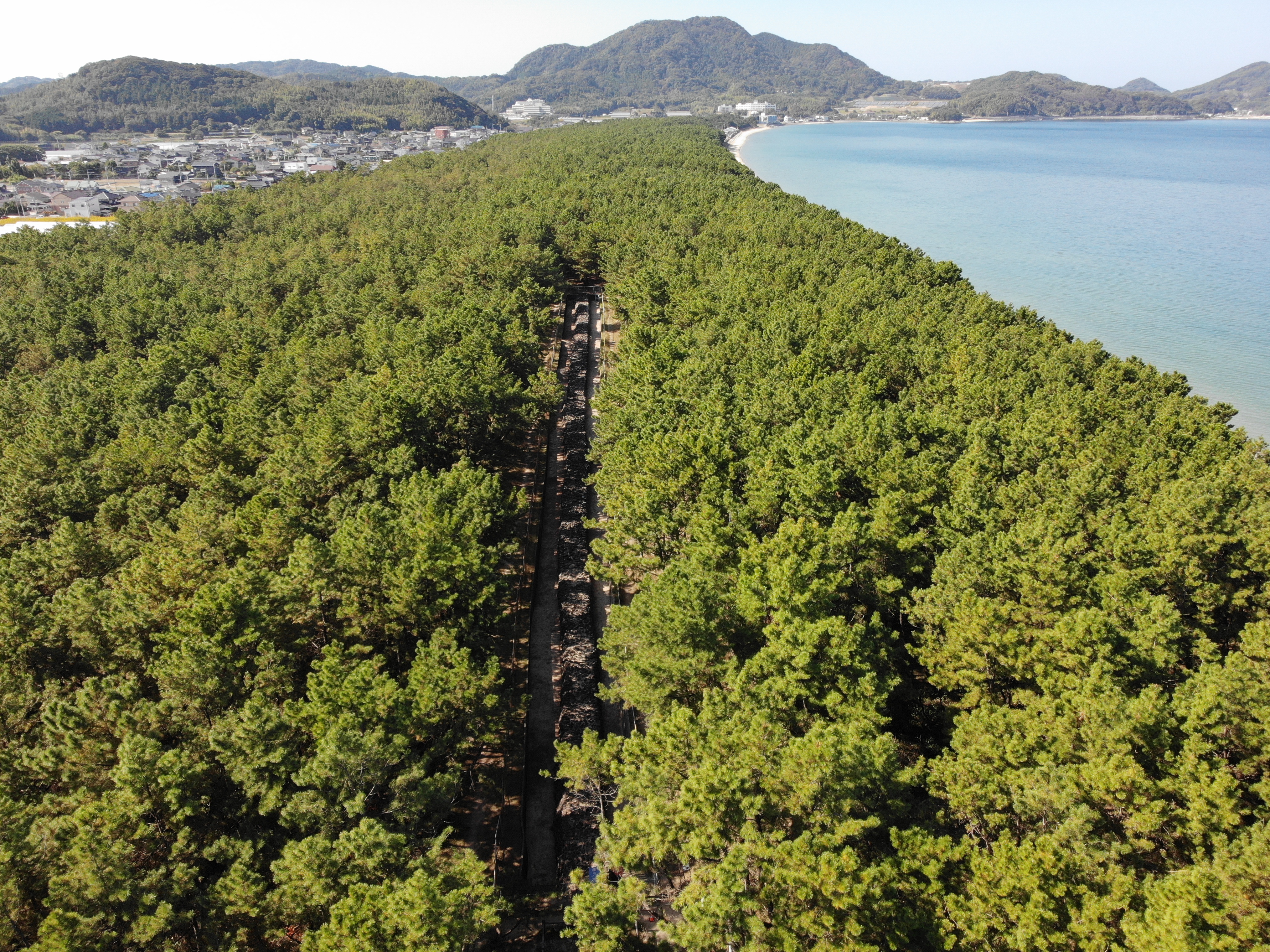
元寇防塁は、鎌倉時代に「元(げん)」という強大な帝国から日本を守るために、博多湾一帯に築かれた石の砦(とりで)です。九州大学元医学部教授の中山平次郎(なかやまへいじろう)博士によりこの名がつけられました。総延長約20㎞の防塁はわずか半年の期間で築かれ、当時は「石築地(いしついじ)」と呼ばれていました。築造の際は、九州の各国が分担していたため、利用されている石や土砂、構造が地区によって異なっています。
今津地区では玄武岩(げんぶがん)を使用する部分(西側)と、花崗岩(かこうがん)を使用する部分(東側)に分かれており、東側の底の部分が西側より20cmほど高くなっています。これは、先に築造された玄武岩側に、花崗岩側を接合する際に生じた段差と考えられています。現在は一部が松原の中に復元整備されています。
日本史上の大事件ともいえる元寇を物語る遺跡としてだけではなく、海岸線に沿って築造されたという特性上、当時の地形を知るための貴重な資料でもあり、市内の7地点10カ所が併せて国史跡に指定されています。
The Genkō (Mongol invasions) Bōrui (defensive ramparts) were stone ramparts built around Hakata Bay in the Kamakura period to defend Japan from the powerful Mongol Empire. The name “Genkō Bōrui” was coined by Dr. Nakayama Heijirō, former professor at Kyushu University’s Faculty of Medicine. The roughly 20-kilometer fortification was constructed in only about half a year and was known at the time as “ishitsukiji” (stone embankments). Because different provinces in Kyushu were assigned different construction sections, the stones, soil, and structural details vary by district.
In the Imazu section, the wall is divided into a western section using basalt and an eastern section using granite; the base level on the eastern side is about 20 cm higher than on the western side. This step is thought to have arisen when the later-built granite section was joined to the earlier basalt section. Today, part of the wall has been restored within a pine grove.
Beyond being ruins of one of the major events in Japanese history, the coastal alignment of the fortifications preserves valuable information about the shoreline’s former topography. Within Fukuoka City, seven areas comprising ten locations are collectively designated as a National Historic Site.
スタンプを獲得すると、限定の壁紙をゲットできます。
スタンプを集めてね / Collect a stamp
限定の壁紙を獲得しました。
以下のボタンから壁紙を表示し、長押しで”写真”に保存してください。