元寇防塁は、鎌倉時代に「元(げん)」という強大な帝国から日本を守るために、博多湾一帯に築かれた石の砦(とりで)です。九州大学元医学部教授の中山平次郎(なかやまへいじろう)博士によりこの名がつけられました。総延長約20㎞の防塁はわずか半年の期間で築かれ、当時は「石築地(いしついじ)」と呼ばれていました。築造の際は、九州の各国が分担していたため、利用されてい石や土砂、構造が地区によって異なっています。
生の松原地区は長垂(ながたれ)海岸から小戸(おど)海岸にかけての約2.5kmにあたります。海への傾斜面に幅1~1.5m、高さ1.8mに石を積み上げ、その後ろを粘土で補強しています。石材は西側に長垂海岸に見られるペグマタイト(花崗岩(かこうがん))、東側に小戸岬一帯の砂岩が使用されており、この石材の違いが分担した国の違いを示すと考えられています。
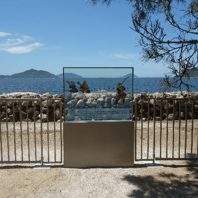
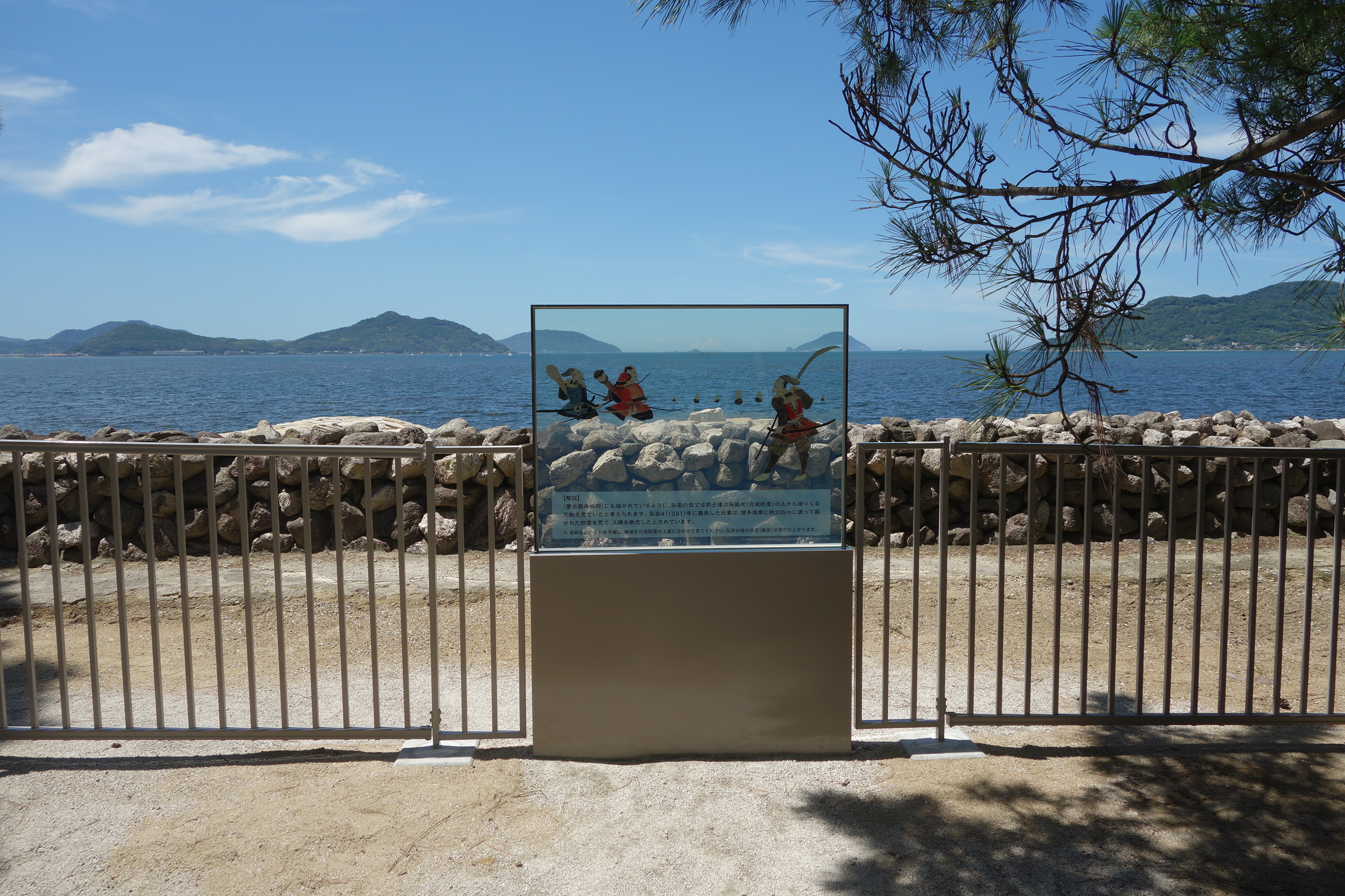
また、『蒙古襲来絵詞(もうこしゅうらいえことば)』に描かれた、肥後(ひご)の御家人(ごけにん)竹崎季長(たけざ(さ)きすえなが)が防塁の前を馬上で進む場面は、この生の松原の情景と考えられています。現在は一部を復元整備し、元軍の船が攻めてくる様子がイメージできるパネルも設置されています。
日本史上の大事件ともいえる元寇を物語る遺跡としてだけではなく、海岸線に沿って築造されたという特性上、当時の地形を知るための貴重な資料でもあり、市内の7地点10カ所が併せて国史跡に指定されています。
The Genkō (Mongol invasions) Bōrui (defensive ramparts) were stone ramparts built around Hakata Bay in the Kamakura period to defend Japan from the powerful Mongol Empire. The name “Genkō Bōrui” was coined by Dr. Nakayama Heijirō, former professor at Kyushu University’s Faculty of Medicine. The roughly 20-kilometer fortification was constructed in only about half a year and was known at the time as “ishitsukiji” (stone embankments). Because different provinces in Kyushu were assigned different construction sections, the stones, soil, and structural details vary by district.
The Ikinomatsubara section runs about 2.5 km from Nagatare Coast to Odo Coast. On the seaward slope, stones were piled to form a wall 1–1.5 meters wide and 1.8 meters high, with the landward side reinforced by clay. The stone materials also differ by location: pegmatite (granite) visible on the western Nagatare Coast, and sandstone around Odo Cape—differences thought to reflect the provinces responsible for each stretch.
A scene in the Illustrated Account of the Mongol Invasions (Mōko Shūrai Ekotoba) showing the Higo retainer Takezaki Suenaga advancing on horseback in front of the rampart is believed to depict this Ikinomatsubara landscape. Today, part of the wall has been restored and on-site panels help visitors picture the Yuan fleet’s approach. Beyond being ruins of one of the major events in Japanese history, the coastal alignment of the fortifications preserves valuable information about the shoreline’s former topography. Within Fukuoka City, seven areas comprising ten locations are collectively designated as a National Historic Site.
スタンプを獲得すると、限定の壁紙をゲットできます。
スタンプを集めてね / Collect a stamp
限定の壁紙を獲得しました。
以下のボタンから壁紙を表示し、長押しで”写真”に保存してください。